
Unsettled Week with Severe Weather Risk
Thunderstorms, Heavy Rain and Hail: DWD Warns of Unpleasant Weather in Kassel
In Kassel and large parts of northern Hesse, the week begins unsettled. According to the German Weather Service (DWD), the risk of thunderstorms, heavy rain, and locally even severe rainfall increases significantly, especially from Tuesday afternoon onwards.
After the warm and sunny start to May, the weather situation is changing: For Kassel, the range extends from thunderstorms with heavy rain on Monday to an increased risk of severe weather on Tuesday evening and during the night to Wednesday. The weather will remain changeable in the middle of the week as well.
Monday in Kassel: first mild, then thunderstorms with heavy rain
On Monday, temperatures will initially reach 20 to 24 degrees. However, as the day progresses, the weather will become noticeably more unsettled. The DWD has already issued a warning for heavy rain on Monday afternoon (May 4) and expects isolated thunderstorms in the north and east during the afternoon and evening.
Heavy rainfall amounts of up to 25 liters per square meter are possible, along with wind gusts around 60 km/h. Small-grained hail is also considered likely. Especially in combination, such thunderstorms can temporarily lead to slippery roads, aquaplaning, and locally flooded underpasses.
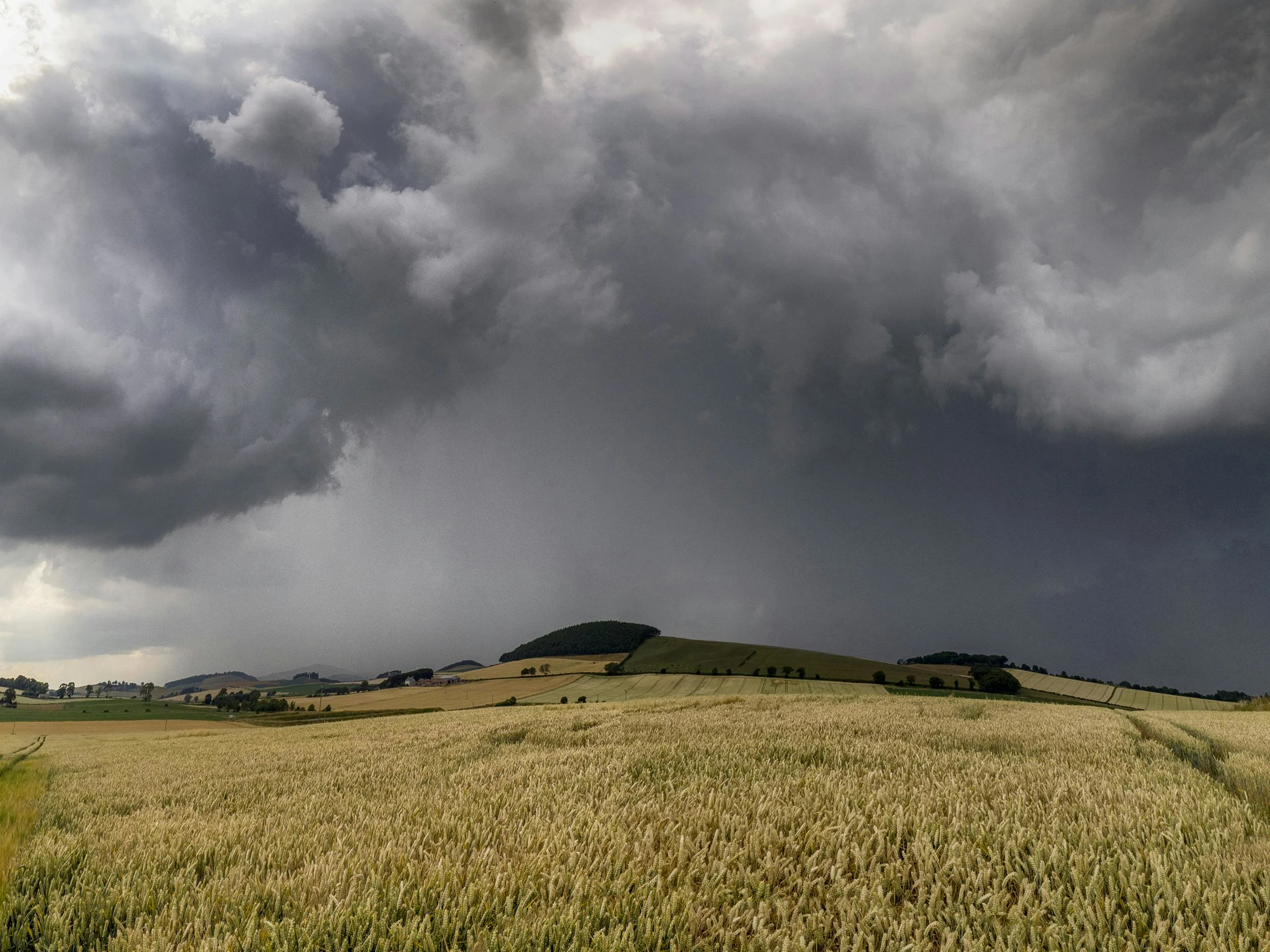
Meteorologically, this fits the picture of a moist, mild air mass under low-pressure influence: Where air is forced to rise on a large scale, light shower cells and thunderstorms form, which can release their precipitation locally and sometimes in a short period of time.
During the night to Tuesday, temperatures will drop significantly. Lows of up to 8 degrees are expected, accompanied by light rain. Fog may form locally; visibility below 150 meters is possible – especially relevant for commuter traffic in the early morning hours.
Tuesday evening and night to Wednesday: highest severe weather risk in northern Hesse
On Tuesday, the weather will initially remain changeable, with showers possible until midday. After that, according to the DWD, the risk of severe weather in Hesse increases noticeably. Meteorologists see the main risk on Tuesday evening and during the night to Wednesday.
Then, thunderstorms with heavy rain between 20 and 30 liters per square meter are again possible. Locally, severe weather with more than 40 liters per square meter cannot be ruled out. What matters is less the daily total than the short time span: When large amounts of rain fall in a short time, the sewage system can be overwhelmed, water quickly accumulates on roads and in depressions, and small streams can swell rapidly.
Temperatures will rise to 16 to 21 degrees on Tuesday. During the night to Wednesday, it will remain mostly cloudy and wet. In the north, persistent heavy rain is possible, while the rain in the south may subside earlier. Noticeable relief is not expected until the second half of the night. Lows will then be between 10 and 6 degrees, and up to 4 degrees in higher elevations.
The driving force behind this development is a cold front approaching from the west: It pushes cooler air under the previously milder air mass. Such transitions are often the phase in which thunderstorms can be particularly strong – because temperature contrasts and the moist air favor the formation of intense shower lines.
Wednesday and Thursday also remain cool, cloudy, and prone to showers
Rapid weather calming is not in sight for the middle of the week. On Wednesday, dense clouds will dominate; showers and isolated thunderstorms are expected in some areas, especially in the north. Highs will be between 14 and 20 degrees.
Thursday will also remain mostly cloudy. Further showers and possible thunderstorms are to be expected. Temperatures will drop a bit further, reaching only 13 to 17 degrees.
For Kassel and northern Hesse, this does not indicate a brief weather blip, but rather a multi-day unsettled phase. The situation remains particularly critical on Tuesday evening and during the night to Wednesday, when locally heavy rain and thunderstorms are possible. Anyone traveling should plan for short-term warnings – especially due to heavy rain, limited visibility, and suddenly occurring gusts.
Frequently Asked Questions
Sources
- https://www.hna.de/hessen/unwetter-in-nordhessen-kassel-warnungen-vor-starkregen-und-gewitter-in-der-livekarte-94290392.html, Florian Dörr, Nora Kraft, 05.05.2026
- https://www.dwd.de/DE/derdwd/aufgaben/aufgaben_node.html
- https://www.wetterdienst.de/Deutschlandwetter/Thema_des_Tages/2018/6/13.html
- https://www.stadt-rees.de/bauen-wirtschaft/tiefbau/starkregen/
- https://www.dwd.de/DE/service/lexikon/begriffe/K/Kaltfront.html
- https://www.wettergefahren.de/warnungen/unwetterwarnkriterien.html